


Pinewood Voting District, Sumter County, South Carolina
About
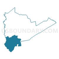
Outline

Summary
| Unique Area Identifier | 666845 |
| Name | Pinewood Voting District |
| County | Sumter County |
| State | South Carolina |
| Area (square miles) | 109.10 |
| Land Area (square miles) | 96.02 |
| Water Area (square miles) | 13.07 |
| % of Land Area | 88.02 |
| % of Water Area | 11.98 |
| Latitude of the Internal Point | 33.75574380 |
| Longtitude of the Internal Point | -80.51900660 |
Maps


Graphs
Select a template below for downloading or customizing gragh for Pinewood Voting District, Sumter County, South Carolina


Neighbors
Neighoring Voting District (by Name) Neighboring Voting District on the Map
- Calvary Voting District, Clarendon County, SC
- Eastover Voting District, Richland County, SC
- Fort Motte Voting District, Calhoun County, SC
- Furman Voting District, Sumter County, SC
- Lone Star Voting District, Calhoun County, SC
- Manchester Forest Voting District, Sumter County, SC
- Paxville Voting District, Clarendon County, SC
- Pocotaligo #2 Voting District, Sumter County, SC
Top 10 Neighboring County Subdivision (by Population) Neighboring County Subdivision on the Map
- Privateer CCD, Sumter County, SC (12,046)
- Summerton CCD, Clarendon County, SC (6,541)
- Eastover CCD, Richland County, SC (5,433)
- Sumter Southwest CCD, Sumter County, SC (4,188)
- Paxville CCD, Clarendon County, SC (2,503)
- Fort Motte-Lone Star CCD, Calhoun County, SC (945)
Top 10 Neighboring Place (by Population) Neighboring Place on the Map
Top 10 Neighboring Unified School District (by Population) Neighboring Unified School District on the Map
- Richland School District 1, SC (201,528)
- Sumter School District 2, SC (57,252)
- Clarendon School District 2, SC (19,243)
- Calhoun County School District, SC (15,175)
- Clarendon School District 1, SC (8,920)
Top 10 Neighboring State Legislative District Lower Chamber (by Population) Neighboring State Legislative District Lower Chamber on the Map
- State House District 67, SC (36,320)
- State House District 64, SC (34,361)
- State House District 93, SC (32,607)
- State House District 70, SC (28,992)
Top 10 Neighboring State Legislative District Upper Chamber (by Population) Neighboring State Legislative District Upper Chamber on the Map
- State Senate District 21, SC (95,133)
- State Senate District 35, SC (87,583)
- State Senate District 36, SC (84,337)
Top 10 Neighboring 111th Congressional District (by Population) Neighboring 111th Congressional District on the Map
Top 10 Neighboring Census Tract (by Population) Neighboring Census Tract on the Map
- Census Tract 19.01, Sumter County, SC (6,373)
- Census Tract 19.02, Sumter County, SC (5,673)
- Census Tract 120, Richland County, SC (5,433)
- Census Tract 18.01, Sumter County, SC (4,188)
- Census Tract 9608.01, Clarendon County, SC (3,606)
- Census Tract 9504, Calhoun County, SC (3,440)
- Census Tract 9604, Clarendon County, SC (2,503)
Top 10 Neighboring 5-Digit ZIP Code Tabulation Area (by Population) Neighboring 5-Digit ZIP Code Tabulation Area on the Map
- 29154, SC (28,135)
- 29102, SC (18,248)
- 29135, SC (8,919)
- 29044, SC (5,652)
- 29168, SC (3,582)
- 29125, SC (3,072)
- 29030, SC (1,967)